
Storm Chasers Track Intense Nebraska Supercell That Snapped Power Poles and Produced Brief Tornado Near Kansas Border
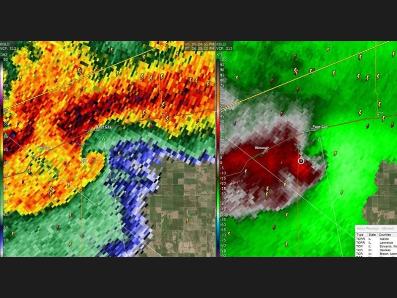
IMPERIAL, NEBRASKA – Storm chasers targeting the high plains intercepted a powerful supercell south of Imperial, Nebraska on Saturday, tracking it through multiple structural changes before it produced a brief, weak tornado near Page City, Kansas and eventually merged with a massive storm system producing damaging winds across western and southwestern Kansas.
The storm initially presented as a disorganized linear system before reorganizing into a structured supercell multiple times throughout the chase. Along the way, it produced intense downburst winds strong enough to snap numerous power poles across the region.
Tornado Wraps Up Nearly on Top of Chasers
As the storm pushed south of Page City, Kansas, it tightened dramatically and produced a brief, weak tornado almost directly over the chase team’s position. Chasers noted they were in near-perfect position for the tornado despite the challenging road network in the area, though the brief and weak nature of the tornado limited the visual encounter.
The storm subsequently evolved into what chasers described as a “giant blue beast” on radar before merging with an intense mesoscale convective system that had already been producing widespread damaging winds across west and southwest Kansas.
Illinois and Indiana Also Hit Hard
Saturday’s severe weather outbreak stretched well beyond the plains, with Illinois and Indiana bearing the brunt of additional storm activity. Chasers noted that both states have faced relentless severe weather this year, with Saturday’s storms adding to what has already been a brutal season for residents across both states.
Stay updated for the latest weather news as this story develops.