
Tornado Watch Issued Through 2 AM for Lexington, Frankfort, Maysville and Much of Central Kentucky
LEXINGTON, KENTUCKY – A Tornado Watch is in effect through 2 a.m. Sunday, June 22 for a large swath of central and northern Kentucky, covering dozens of counties including some areas that have already dealt with severe weather in recent days.
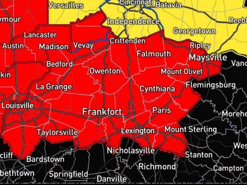
The watch zone spans a significant portion of the state, taking in major population centers including Lexington, Frankfort, Louisville, Georgetown, Winchester, and Maysville, along with smaller communities such as Cynthiana, Falmouth, Paris, Nicholasville, Owenton, Mount Sterling, and Flemingsburg.
Several Communities Under the Watch Again
Forecasters noted that Lexington, Georgetown, Winchester, and Maysville are included in the watch area once again, suggesting those communities have seen recent rounds of severe weather already this weekend. The watch covers a broad north-to-south corridor through the heart of the state, stretching from the greater Cincinnati area near Independence and Crittenden in the north down through the Bluegrass Region and into areas around Richmond and Danville to the south.
Portions of southern Indiana, including communities near Vevay, Madison, and Bedford, also fall within the red watch zone on the map.
Residents in the Watch Area Urged to Stay Alert
A Tornado Watch means conditions are favorable for tornado development and severe thunderstorms across the region. Residents within the watch area are urged to stay weather-aware, monitor local forecasts and emergency alerts, and be prepared to take shelter quickly if a Tornado Warning is issued for their specific location.
Stay updated for the latest weather updates as this story develops.